A Map of Anguilla Can Help You Find Your Way Around this Untouched Paradise
Use a map of Anguilla to find your way to exotic beaches and villas on this beautiful, untarnished speck of paradise in the Leeward Islands.
It's a rocky road,
Down Bankie's dune,
Made of memories and bits of moon...
Bacon Brothers, It's A Rocky Road
 |
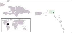
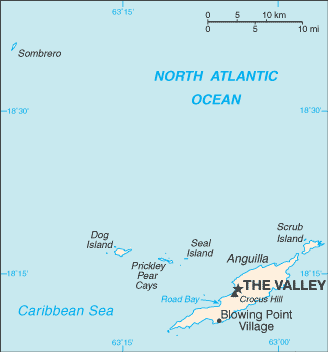
Anguilla is approximately 150 miles to the east of Puerto Rico, and nine miles or so north of the Netherland Antilles. At only 35 square miles (16 miles long and 3 miles wide at its widest point), finding your way around Anguilla is a breeze, especially if you have an Anguilla map. However, to make matters slightly more difficult, six smaller islands are also part of this small Caribbean island. They are Anguilliate, Dog Island, Prickly Pear, Sandy Island, Scrub Island, and Sombrero.
There are a few maps of Anguilla below, to help you find that perfect slice of pristine sand, or to help you find your way back to your hotel after the next Buffett show at Bankie Banx's Dune Preserve, including the latest interactive maps from Google.
Maps of Anguilla: Overview

Interactive: Anguilla Map
Leave Map of Anguilla and Return to Eastern Caribbean Islands Maps
Leave Anguilla Map and Return Home

